SurPad
SurPad is a simple yet powerful field software for surveying that runs on Android, which ensures a high recognition factor. With user-friendly functions, you perform most types of measurement work without worries, regardless of whether it concerns measurement, release or e.g. surface control. Thanks to a powerful CAD engine, you can also calculate areas, angles and lengths and create your own exposure data directly in the field.
Downloads
-
Appearance
Choose which functions you want to see on the home screen. Turn off all you do not use or choose to show everything. It's entirely up to you.
-
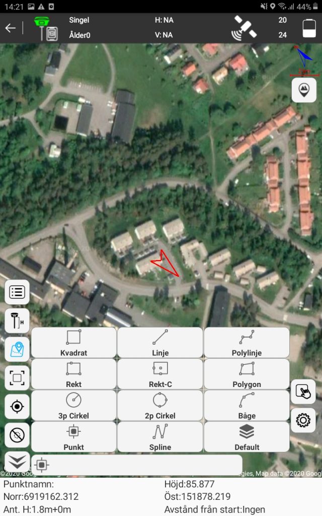
Measure
Measure correct geometries directly in the field. You can also control which tools should be available as hotkeys next to the left side of the screen. Of course, the information field at the bottom is also configurable.
-
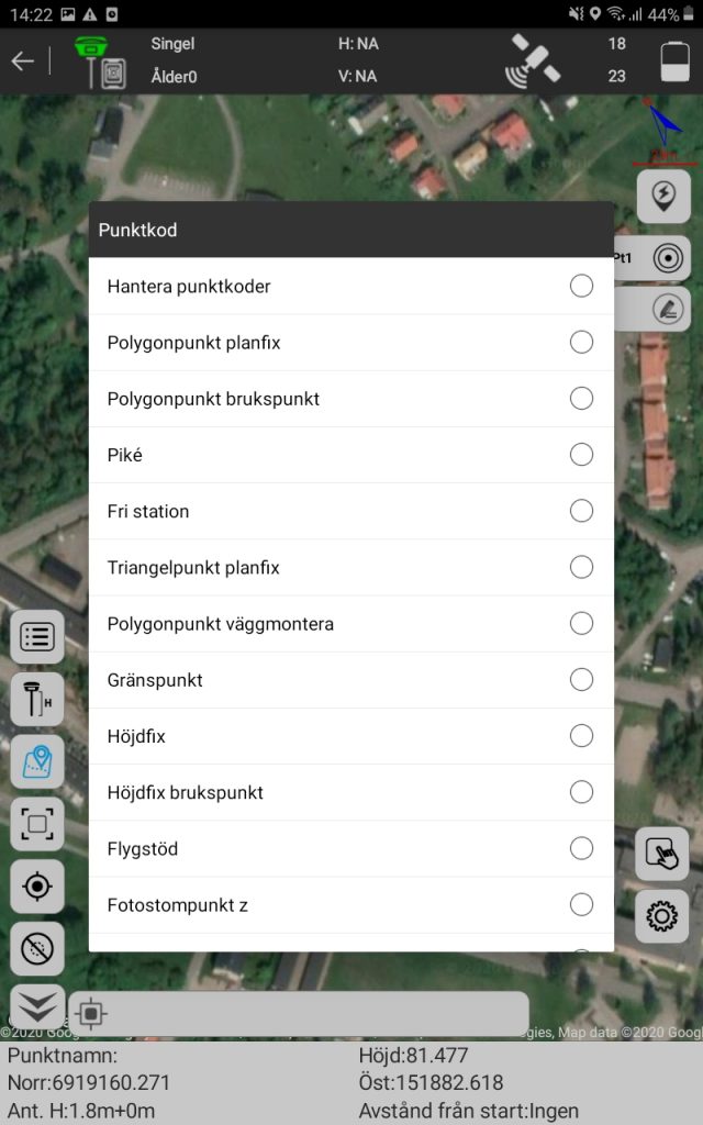
Coding
Code with a predefined code list or create your own as you measure.
-
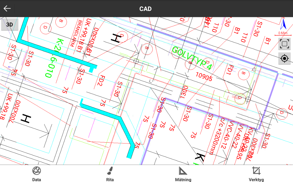
CAD / Stake-out
Stake out from drawings in e.g. dxf format. Just select the object you want to stake out and then the program switches to measure mode - whether it's a point or line.
-
Height control
Check heights against surface models.
-
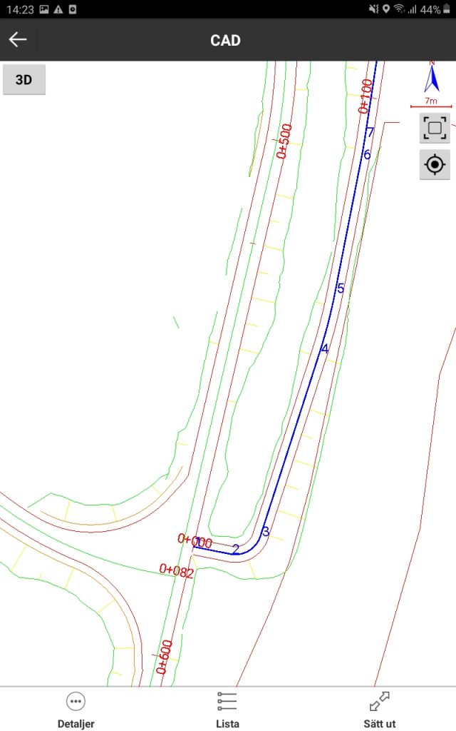
Road line Stake-out
Stake out relatively a road line - get rolling values of your position relatively e.g. center road with reference values to section and offset. It is also possible to combine a surface model and road line, then you get heights from the surface model and section / offset values relatively to the road line.
-
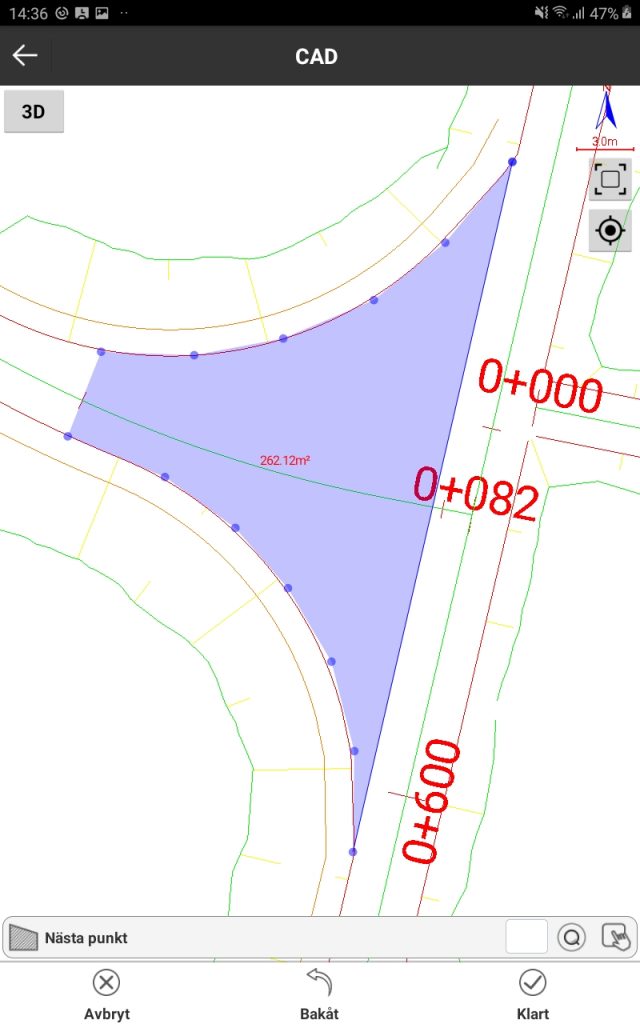
Area calculation and length measurement
Calculate areas and angles and check lengths directly in the field. Really flexible and useful function for anyone who does not have access to office software.
-
Create Stake-out data
Create your own stake out data using a lot of useful features. If you have access to a decent floor plan, you can basically produce anything.
What's included
-
Full license
All functionality described above is included, making SurPad a complete field software for surveying.
12 000Kr
Runs preferably on one of our Field controllers M-Tab or M-Con. Also, supplement with support agreements to guarantee maximum use of the program. Find our complete offering of GNSS receivers here.
Contact us